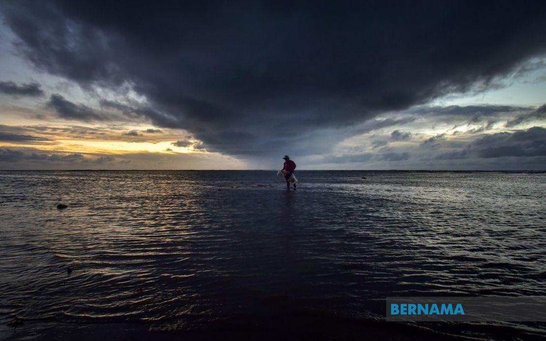
A significant weather system is poised to unleash thunderstorms, torrential downpours and gusty conditions across much of the country this afternoon, according to the Malaysian Meteorological Department. The alert encompasses virtually all of Peninsular Malaysia alongside substantial portions of Sabah, Sarawak and the Federal Territory of Labuan, with meteorologists warning that hazardous conditions will persist until 5 pm.
The entire states of Perlis and Penang fall squarely within the warning zone, making these northwestern regions among the areas most exposed to the developing weather system. In Kedah, residents in Langkawi—a popular tourist destination—along with Kubang Pasu, Padang Terap, Sik, Baling, Kulim and Bandar Baharu should prepare for rapid deterioration in conditions. The affected districts span both urban and rural areas, suggesting that the weather front has considerable geographic scope.
Perak, a state spanning both peninsula coasts, faces extensive coverage under the alert. Eleven districts have been flagged, including Kerian and Larut on the western flank, the hilly interior zones of Hulu Perak and Kuala Kangsar, and the industrialised regions of Manjung and Kinta. Kampar, Batang Padang and the Muallim area round out the warning area, indicating that no significant portion of the state escapes the projected disturbance. This breadth of coverage suggests a robust weather system rather than isolated convective activity.
Central Peninsular Malaysia faces similarly broad exposure. In Pahang, the mountainous Cameron Highlands tourist region alongside Raub, Bentong and the coastal district of Rompin are all positioned within the warning footprint. The presence of Cameron Highlands—a region already prone to heavy rainfall and landslides during monsoon periods—warrants particular attention from residents and authorities. Selangor, encompassing the Klang Valley, has three districts marked: Hulu Selangor, Gombak and Hulu Langat, areas that experience frequent flash flooding during intense rain episodes. Negeri Sembilan's central and southern districts of Jelebu, Seremban, Kuala Pilah, Jempol and Tampin are similarly exposed.
The southern peninsula shows more limited but still notable exposure. In Johor, the eastern districts of Mersing and Kota Tinggi face the brunt of conditions. These coastal-leaning areas occasionally experience marine impacts during severe weather, potentially affecting fishing communities and maritime traffic in the Straits of Johor.
Sabah experiences substantial coverage concentrated in its interior and eastern regions. The Interior division encompasses Sipitang, Tenom, Kuala Penyu, Beaufort and Tambunan—predominantly rural, mountainous terrain where heavy rainfall poses risks for landslides and disruption to agricultural activities. The West Coast division and eastern zones including Kunak, Lahad Datu, Beluran and the northern district of Kudat round out Sabah's warning area. The Federal Territory of Labuan, an offshore financial centre, is also included in the alert.
Sarawak, Malaysia's largest state by area, faces an even more geographically dispersed warning. Affected localities stretch from the western Kuching division—encompassing the capital and nearby Bau—through the central longhouse regions of Sarikei, Kapit and Mukah, extending eastward to the coastal and interior zones of Bintulu, Miri and Limbang. The inclusion of multiple divisions indicates the weather system's substantial scale and intensity. Communities in these regions, many dependent on river transport and agriculture, face potential disruption from the forecasted conditions.
Thunderstorm warnings of this geographic magnitude typically accompany moisture-laden air masses or the leading edge of a major monsoon surge. The afternoon timeframe—with the warning extending until 5 pm—suggests peak heating of the day is fuelling atmospheric instability. For Malaysian residents and visitors, the immediate implications include hazardous driving conditions, potential power outages from lightning strikes, and possible flash flooding in low-lying areas and near watercourses. Schools and outdoor activities may face disruption, whilst maritime operators should exercise heightened caution.
The breadth of this warning underscores MetMalaysia's assessment of a systematic weather feature rather than scattered afternoon showers. Residents are advised to monitor further updates from the meteorological authority, secure loose outdoor items, and remain indoors during the peak of the disturbance. The afternoon window means commuters travelling during the late afternoon should exercise extreme care on roads where visibility may be severely compromised. Tropical regions such as Malaysia frequently experience such weather volatility, yet the extent of today's warning suggests above-average severity warranting public preparedness.
%22%2F%3E%3C%2Fpattern%3E%3C%2Fdefs%3E%3Crect%20width%3D%22100%25%22%20height%3D%22100%25%22%20fill%3D%22url(%23ph6xupg)%22%2F%3E%3Crect%20width%3D%22100%25%22%20height%3D%22100%25%22%20fill%3D%22url(%23ph6xupp)%22%2F%3E%3Ctext%20x%3D%2250%25%22%20y%3D%2250%25%22%20text-anchor%3D%22middle%22%20dominant-baseline%3D%22central%22%20fill%3D%22rgba(255%2C255%2C255%2C0.95)%22%20font-family%3D%22Georgia%2C%20'Times%20New%20Roman'%2C%20serif%22%20font-weight%3D%22700%22%20font-size%3D%22170%22%20letter-spacing%3D%22-0.02em%22%3EMalaysia%3C%2Ftext%3E%3C%2Fsvg%3E)
%22%2F%3E%3C%2Fpattern%3E%3C%2Fdefs%3E%3Crect%20width%3D%22100%25%22%20height%3D%22100%25%22%20fill%3D%22url(%23ph6450g)%22%2F%3E%3Crect%20width%3D%22100%25%22%20height%3D%22100%25%22%20fill%3D%22url(%23ph6450p)%22%2F%3E%3Ctext%20x%3D%2250%25%22%20y%3D%2250%25%22%20text-anchor%3D%22middle%22%20dominant-baseline%3D%22central%22%20fill%3D%22rgba(255%2C255%2C255%2C0.95)%22%20font-family%3D%22Georgia%2C%20'Times%20New%20Roman'%2C%20serif%22%20font-weight%3D%22700%22%20font-size%3D%22136%22%20letter-spacing%3D%22-0.02em%22%3EGovernment%3C%2Ftext%3E%3C%2Fsvg%3E)
%22%2F%3E%3C%2Fpattern%3E%3C%2Fdefs%3E%3Crect%20width%3D%22100%25%22%20height%3D%22100%25%22%20fill%3D%22url(%23ph2ojpsg)%22%2F%3E%3Crect%20width%3D%22100%25%22%20height%3D%22100%25%22%20fill%3D%22url(%23ph2ojpsp)%22%2F%3E%3Ctext%20x%3D%2250%25%22%20y%3D%2250%25%22%20text-anchor%3D%22middle%22%20dominant-baseline%3D%22central%22%20fill%3D%22rgba(255%2C255%2C255%2C0.95)%22%20font-family%3D%22Georgia%2C%20'Times%20New%20Roman'%2C%20serif%22%20font-weight%3D%22700%22%20font-size%3D%22194%22%20letter-spacing%3D%22-0.02em%22%3EBercham%3C%2Ftext%3E%3C%2Fsvg%3E)