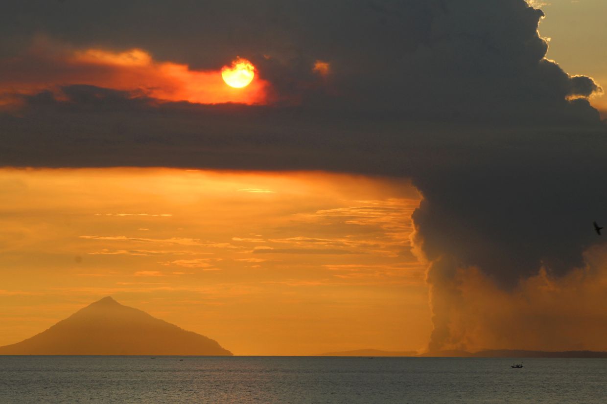
Indonesia's Mount Anak Krakatau erupted on Tuesday morning, releasing a towering ash column that rose approximately 100 metres above the volcano's crater in the Sunda Strait. The eruption, recorded at 8:21 a.m. local time according to the Geological Agency of the Energy and Mineral Resources, propelled dense gray ash northwestward while seismic instruments registered maximum amplitude readings of 11 millimetres with a duration lasting roughly 15 seconds. This latest outburst marks the fifth eruption since the current eruptive cycle commenced in late June, underscoring the volcano's transition from an extended dormancy period into a phase of sustained and escalating unrest.
The remarkable acceleration in volcanic activity has prompted Indonesian authorities to heighten their response posture substantially. Friday's decision to elevate Mount Anak Krakatau's alert classification from Level II to Level III—the penultimate tier in Indonesia's four-stage volcanic warning system—reflects deepening official concern about the volcano's trajectory. Andi Suwardi, head of the Mount Anak Krakatau Observation Post based in South Lampung, emphasized that despite the ongoing eruptions and observable fluctuations in activity patterns, the alert status remains at its newly established elevated position. His reassurance rings somewhat hollow given the dramatic intensification in monitored parameters since early June, when the volcano had languished in relative quiescence for an extended interval.
The recent seismic data paints a picture of accelerating unrest that demands serious consideration from both residents and visitors to the region. Between June 18 and June 19 alone, monitoring stations recorded more than 50 tremors and low-frequency earthquake events daily. This frequency continued climbing through the period from June 16 to July 2, with average daily occurrences reaching 97 events—nearly doubling the earlier two-day surge. Such rapid escalation in earthquake frequency typically signals rising magmatic pressure beneath the volcanic edifice, a concerning indicator that prompted authorities to establish a three-kilometre exclusion zone centring on the crater itself. Continuous 24-hour surveillance by observation post teams attempts to track subtle shifts in this trajectory, scrutinizing ash plume heights and seismic signatures as leading indicators of potential large-scale eruptive episodes.
For Malaysian readers and Southeast Asian observers, Mount Anak Krakatau's renewed activity carries particular significance given the regional interconnectedness of volcanic and seismic hazards. The volcano's name itself—meaning "Child of Krakatau"—references its emergence from the sea in 1927 within the caldera left by one of history's most catastrophic volcanic events. The 1883 eruption of its parent volcano remains etched in the regional consciousness: that unimaginably violent explosion generated powerful shock waves, triggered devastating tsunamis that radiated across the Indian Ocean, and killed approximately 36,000 people across the broader region. The eruption's atmospheric effects disrupted global weather patterns and climate conditions for months afterward, demonstrating the continent-spanning consequences of major tropical volcanic events.
The threat Mount Anak Krakatau poses extends beyond its own immediate footprint, as the volcano's 2018 eruption demonstrated with stark clarity. On December 22, 2018, a destabilizing collapse of the volcano's flank triggered a tsunami that reached coastal populations across southern Sumatra and western Banten within minutes. That single disaster claimed at least 429 lives and injured more than 7,200 others, inflicting profound trauma upon fishing communities, tourism operators, and hundreds of families whose members perished unexpectedly. The proximity of major population centres and busy maritime routes to the Sunda Strait amplifies the stakes whenever Mount Anak Krakatau enters phases of heightened instability.
Local economic pressures directly complicate the government's public safety messaging, creating tensions between immediate livelihood imperatives and longer-term risk management. South Lampung Regent Radityo Egi Pratama acknowledged candidly that heightened volcanic activity has disrupted economic activities for communities historically dependent upon maritime resources and tourism centred on the volcano itself. Fishing families facing restricted access to traditional grounds and tourism operators watching their income streams evaporate understandably struggle with the necessity of prolonged avoidance. Despite these hardships, Egi stressed unambiguously that public safety remains paramount, urging both fishermen and tourism entrepreneurs to cease operations near the volcano until authorities signal that danger levels have subsided.
Yet enforcement of these safety protocols remains persistently challenging for Indonesian authorities. Despite official restrictions and warnings, some fishermen and tourism operators continue venturing into waters surrounding Mount Anak Krakatau, attempting to evade monitoring and apprehension by authorities. These individuals clearly calculate that the economic necessity of maintaining their livelihoods outweighs the assessed danger posed by volcanic activity. Such persistent non-compliance reflects the desperation of populations whose economic alternatives remain extremely limited, even as it exposes families and workers to potentially catastrophic risks during an active volcanic phase.
The broader context of Mount Anak Krakatau's current unrest also warrants consideration within Southeast Asia's wider volcanotectonic environment. The region sits astride the Ring of Fire, a zone of intense seismic and volcanic activity encircling the Pacific Ocean basin. Indonesia itself hosts more active volcanoes than any other nation on Earth, confronting government agencies with the perpetual challenge of monitoring, interpreting, and communicating volcanic hazards across an enormous archipelago of diverse populations and geographies. The expertise accumulated through decades of volcanic monitoring in Indonesia represents invaluable knowledge for the broader region, particularly as climate change potentially alters precipitation patterns and slope stability conditions affecting volcanic systems.
The observation post teams maintaining 24-hour surveillance of Mount Anak Krakatau gather real-time data that contributes to Indonesia's sophisticated understanding of volcanic behaviour and hazard forecasting. Modern seismic networks, satellite monitoring, and traditional observation techniques combine to provide authorities with increasingly refined capacity to detect changes in volcanic activity and issue timely warnings to potentially affected populations. Andi Suwardi's emphasis on continuous monitoring underscores the vigilance required when managing active volcanic systems that threaten substantial populations and economically vital regions. The transition from the relatively dormant period to the current high-activity phase occurred within weeks, illustrating how rapidly volcanic systems can destabilize.
Government messaging attempts to balance transparency about escalating risks with maintaining public confidence in official capacity to manage the situation. By maintaining Mount Anak Krakatau at Level III alert status rather than escalating further to Level IV (Evacuation Imminent), authorities signal that they assess the danger as serious but not imminently catastrophic. This calibrated positioning allows economic activities to continue in areas deemed safer while concentrating restrictions around the most dangerous zones proximate to the volcano itself. Should seismic activity accelerate further or eruptions dramatically increase in scale and frequency, however, authorities would likely face pressure to escalate alert levels and implement broader restriction zones.
For residents throughout the Sunda Strait region and across Indonesia more broadly, Mount Anak Krakatau's latest eruptive phase serves as a potent reminder of the geological dynamism underlying daily life in the archipelago. Volcanic hazards represent an ineliminable component of the Indonesian environment, requiring constant preparedness, adaptive management of economic activities, and sophisticated technical expertise. The coming weeks will prove critical in determining whether the current escalation in seismic activity and eruption frequency stabilizes at manageable levels or progresses toward another major eruptive episode comparable to the devastating 2018 event. Until such time, Indonesian authorities maintain their vigilant posture, communities balance safety against economic necessity, and the volcano itself continues speaking in the ancient language of seismic tremors and ash plumes.

