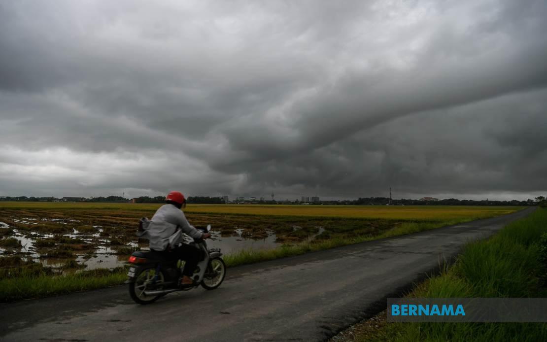
The Malaysian Meteorological Department has activated a widespread severe weather alert affecting eight states across the country, warning residents of potentially dangerous thunderstorms, torrential downpours, and gusty conditions expected to persist through the early evening hours. The alert, issued on July 4, encompasses a substantial geographic area spanning from the northern peninsula through to the East Malaysian states, indicating a significant weather system affecting multiple population centres and rural areas simultaneously.
In Peninsular Malaysia's northwest, the alert encompasses five districts within Kedah, specifically targeting residents and travellers in Kota Setar, Yan, Pendang, Kuala Muda, and Sik. These areas, which span both urban and agricultural regions, face the prospect of flash flooding and localised disruptions to transportation networks. The adjacent state of Perak likewise comes under the warning umbrella, with two central districts—Manjung and Perak Tengah—identified as particularly vulnerable to the forecasted severe conditions.
East Coast communities are similarly affected, with the alert encompassing Kemaman in Terengganu and Kuantan in Pahang. These regions, which frequently experience monsoonal influences and are accustomed to heavy seasonal rainfall, may nonetheless face intensity levels that challenge drainage infrastructure and transport corridors. The inclusion of Hulu Langat in Selangor, a densely populated area proximate to the Klang Valley conurbation, suggests the potential for weather disruptions affecting the nation's economic heartland and the daily routines of millions of commuters.
Negeri Sembilan's two administrative divisions—Jelebu and Seremban—round out the Peninsular Malaysia component of the warning. Seremban, as the state capital, houses significant government and commercial activities that could face temporary disruption should the forecasted conditions materialise with full intensity. The inclusion of both urban and rural areas underscores the weather system's broad geographical extent and its capacity to affect diverse terrain and infrastructure types.
In East Malaysia, Sarawak faces alerts affecting two distinct regions. The warning targets Sarikei district and simultaneously covers Mukah encompassing its associated settlements of Tanjung Manis and Daro. These coastal and river-delta communities in Sarawak remain particularly susceptible to weather-related flooding given their geography and proximity to waterways. The alert's extension to Sarawak reflects the weather system's reach across the South China Sea region and demonstrates the coordinated forecasting capability of Malaysia's meteorological operations.
Sabah experiences the most granular alert structure, with three geographic divisions identified. The Interior Division faces threats to Keningau and Tambunan, highland communities where heavy rainfall can trigger landslides and terrain instability. The West Coast Division's alert covers Papar and Penampang, both strategically significant areas near major population and industrial concentrations. Sandakan district's inclusion specifically highlights Kinabatangan, a locality with important economic and demographic significance in Sabah's eastern region.
The temporal constraint of the warning—limited to six o'clock this evening—suggests forecasters assessed the weather system as relatively transient in nature, though potentially intense during its passage. This relatively short-duration alert window is significant for emergency response planning, as it concentrates response protocols and public advisories into a defined timeframe rather than extending uncertainty across multiple days.
Severe weather alerts of this geographic scope carry substantial implications for daily operations across multiple sectors. Transportation authorities typically increase monitoring of highways and rail networks vulnerable to flooding, while aviation authorities scrutinise operations at regional airports. Utility companies prepare for potential infrastructure damage from wind and lightning strike incidents. Emergency response agencies position resources to address weather-related incidents including traffic accidents, building damage, and potential landslides in vulnerable terrain.
Public behaviour responses to such alerts vary considerably depending on population density and prior weather experience. Urban populations may experience temporary disruptions to routine activities, whilst agricultural communities and those dependent on water transport face more pronounced operational challenges. The simultaneous coverage of both Peninsular and East Malaysia indicates a significant weather system rather than isolated localised phenomena, warranting coordinated national response frameworks.
Malaysian residents and businesses in the affected zones are typically advised to secure loose outdoor items, avoid unnecessary travel during peak intensity periods, and monitor weather updates through MetMalaysia's official channels. For those in flood-prone areas, preparedness includes securing important documents and maintaining awareness of evacuation routes. The meteorological department's explicit geographic delineation enables targeted public communication rather than blanket national advisories, allowing communities outside alert zones to proceed with normal activities.
The precision of MetMalaysia's district-level forecasting reflects decades of accumulated meteorological data and increasingly sophisticated modelling systems. Such granular warnings serve both public safety objectives and economic efficiency by preventing unnecessary precautionary measures across unaffected territories. As climate patterns continue shifting and weather variability increases, the capability to issue timely, geographically precise alerts becomes ever more valuable for national disaster preparedness and economic continuity planning.