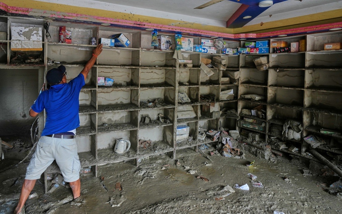
A deadly mudslide that struck Gyirong Port in southwest China's Xizang Autonomous Region on August 26 has been traced to a glacier collapse originating across the border in Nepal, regional authorities confirmed on Sunday. The disaster represents a sobering example of how mountain hazards in the Himalayan region can transcend international boundaries, with profound consequences for communities situated downstream from high-altitude glacial zones.
According to findings presented at a press conference by the Xizang regional government's information office, the catastrophe began when a glacier located on the south slope of Mount Langtang Lirung fractured at approximately 5,200 metres above sea level. This rupture released a massive volume of ice, rock, and debris that became an avalanche descending rapidly down the mountainside. The initial ice-rock avalanche, as it tumbled through the steep terrain, gathered additional material from the slopes it traversed, transforming into what experts classify as a debris flow—a more fluid and far-reaching phenomenon than a simple avalanche.
The debris flow descended approximately 3,200 vertical metres in a relatively short distance, covering about 22 kilometres horizontally before reaching Gyirong Port, situated at an altitude of roughly 1,800 metres. This extraordinary travel distance underscores the tremendous velocity and destructive energy contained within the mudslide as it raced downslope. The concentrated force of the debris flow flattened approximately 0.7 square kilometres of land surrounding the port, completely destroying 27 buildings and associated infrastructure in the impact zone. Gyirong Port, an important trading point and gateway community in the region, bore the brunt of this natural disaster.
The death toll from this transnational disaster reached 16 confirmed victims by Saturday evening, with 546 people reported missing as of 6 pm that day, according to official figures released Sunday morning by the regional government. These figures underscore the intensity of the impact and the scale of the humanitarian emergency that unfolded in the hours and days following the mudslide. The missing persons count suggests that many individuals in the affected area may remain trapped beneath debris or have been swept further downslope by the torrent of mud and rock.
The identification of the glacier source across the Nepal border was accomplished through sophisticated scientific analysis conducted by the Institute of Mountain Hazards and Environment, a research institution under the Chinese Academy of Sciences. This cryosphere emergency disaster response team employed multiple methodologies to establish the connection between the Himalayan glacier and the Xizang mudslide. Their investigative approach combined remote-sensing monitoring data—satellite imagery and ground-based sensors that tracked the avalanche's progression—with field-transmitted real-time data collected during and after the event, supplemented by comprehensive on-site surveys and investigations by specialists who visited the affected area.
The Mount Langtang Lirung region where the glacier fractured sits in a geologically sensitive area of the high Himalayas, where the collision between tectonic plates, coupled with climate-driven changes to mountain glaciers, creates conditions conducive to catastrophic instability. The fracture at 5,200 metres represents a failure point where accumulated stress within the glacier finally exceeded the structural integrity of the ice. The subsequent avalanche's transformation into a debris flow illustrates how initial gravitational instability in high mountain terrain can cascade into increasingly destructive phenomena as the moving mass incorporates additional loose material from the mountainside.
For Malaysia and Southeast Asia, this incident provides important lessons about regional vulnerability to cross-border natural hazards. While the Himalayan mountain range lies beyond Southeast Asia's immediate geography, the mechanisms that generated this disaster—glacial instability, climate change impacts on high-altitude ice, and the propagation of mountain hazards across long distances—resonate with similar geological and climatic processes affecting mountain regions throughout Asia. Countries in Southeast Asia with significant mountainous terrain, including components of Myanmar, Laos, Thailand, and northern Malaysia, should consider how comparable glacial and avalanche hazards might manifest in their own jurisdictions, even if on different temporal and spatial scales.
The transnational nature of this disaster highlights the importance of regional cooperation in mountain hazard monitoring and early warning systems. Nepal and China, despite periodic diplomatic tensions, must maintain scientific collaboration to understand and predict such catastrophic events. This principle extends throughout Asia: shared river systems, overlapping mountain ranges, and atmospheric circulation patterns mean that natural hazards in one nation frequently impact neighbours downstream or downwind. For Southeast Asian countries, strengthening ties with regional geological and meteorological agencies could enhance collective capacity to respond to and mitigate the effects of mountain-related disasters.
Climate change adds urgency to these concerns. Himalayan glaciers have been retreating for decades, and many researchers anticipate that this trend will accelerate in coming years. The fracture at Mount Langtang Lirung may represent either a one-off event or a harbinger of increasing instability in glacier systems across the region as warming temperatures destabilise previously stable ice masses. Rapid glacier melt can weaken the cohesion of ice and rock, creating conditions where avalanches and debris flows become more frequent and potentially more severe. Understanding these dynamics becomes essential for any mountain community positioned downstream from glaciated terrain.
The response by Chinese authorities and the rapid deployment of the Institute of Mountain Hazards and Environment team demonstrates the institutional capacity that exists within the region for disaster assessment and scientific investigation. However, the tragic human toll—16 confirmed deaths and hundreds missing—reminds all governments of the limits of prediction and response when natural forces of this magnitude are unleashed. Gyirong Port's recovery will require sustained international support and investment in infrastructure resilience. For policymakers throughout Asia, including those in Malaysia and other Southeast Asian nations, this disaster serves as a powerful reminder that investment in early warning systems, disaster preparedness, and scientific understanding of mountain hazards represents not merely an academic exercise but a practical necessity for protecting vulnerable populations.

