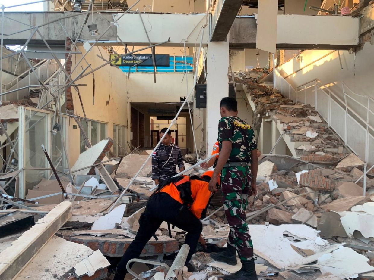
A powerful magnitude 7.7 earthquake rocked Indonesia's Flores region in the early hours of Saturday, August 15, destroying structures and claiming at least two lives in an area with a troubling history of seismic devastation. The tremor struck at 5:58 a.m. local time with its epicenter positioned approximately 68 kilometers north-northwest of the city of Ende in East Nusa Tenggara province, at a relatively shallow depth of 10 kilometers according to the U.S. Geological Survey. The initial shock was followed by successive aftershocks that kept residents on edge and complicated rescue and assessment efforts throughout the morning.
The immediate impact on the ground was severe and widespread. Preliminary reports from the Maumere Search and Rescue Agency documented at least two fatalities and two additional injuries, with the destruction particularly concentrated in populated areas where buildings simply could not withstand the violent ground motion. Yohanna Embu, a resident of Sikka regency within East Nusa Tenggara, described the chaotic scene unfolding around her, recounting how numerous structures sustained substantial damage and terrified residents instinctively rushed toward higher elevations in search of safety. She specifically noted the collapse of the waiting room at Maumere's port terminal, a facility that serves as a crucial transportation hub for the region, underscoring how the quake affected both residential and commercial infrastructure.
The impact extended to religious and educational facilities across Flores. At St. Peter Major Seminary in Sikka, known locally as Ritapiret Seminary, morning Mass took a terrifying turn when the roof of the assembly hall suddenly gave way. Reverend Guidelbertus Tanga, the seminary's rector, recounted how students and nuns fled in panic as the structure collapsed around them. The emergency was compounded when at least one priest sustained a broken leg after jumping from a second-floor window during the violent shaking, an act of desperation that underscores the intensity of the earthquake's effects on human behavior and the split-second decisions people must make during such catastrophic events.
Immediate response from authorities focused initially on potential secondary disasters beyond the quake itself. Indonesia's Meteorology, Climatology and Geophysics Agency issued a tsunami warning for several provinces including East Nusa Tenggara, West Nusa Tenggara, South Sulawesi and Southeast Sulawesi, directing residents away from beaches and riverbanks while urging coastal populations to seek higher ground. This precautionary approach reflected the region's vulnerability to tsunami generation given the shallow underwater location of the epicenter near Flores island. However, monitoring of sea levels showed no significant abnormal changes that would threaten coastal communities, leading authorities to lift the tsunami alert and allowing some measure of relief among populations who had already endured the primary shock.
Healthcare facilities across the affected areas moved quickly into emergency protocols. Footage from local television stations captured the evacuation of patients from multiple hospitals as a protective measure, with staff relocating beds, intravenous stands and oxygen cylinders to temporary outdoor treatment areas. This improvisation reflected both the immediate danger posed by potential structural collapse and the need to continue providing critical medical care during the chaotic aftermath of a major seismic event. Such responses, while logistically challenging, likely prevented additional casualties among vulnerable populations already stressed by the earthquake's impact.
Geographically and geologically, Flores island's exposure to seismic hazards reflects Indonesia's precarious position within the global tectonic system. The nation, comprising more than 17,000 islands stretched across the equatorial Pacific, sits squarely atop the Ring of Fire—a notorious arc of volcanoes and fault lines encircling the Pacific Basin. This positioning makes Indonesia one of the world's most seismically active countries, with earthquakes an almost routine occurrence rather than an exceptional event. The region's vulnerability is not merely theoretical; the historical record provides sobering evidence of the destructive potential lurking beneath the region's islands.
The 1992 earthquake that struck the southeastern island of Flores serves as a grim reminder of what the region faces when major seismic events occur near populated areas. That December disaster generated a tsunami that claimed approximately 2,500 lives, making it one of the deadliest earthquake-tsunami combinations in modern history. The catastrophe unfolded in the same general area as Saturday's quake, on islands forming part of eastern Indonesia's vulnerable archipelago. That previous tragedy profoundly shaped how authorities and residents approach earthquake alerts and tsunami warnings in the present day—the speed with which warnings were issued and the rapid evacuation of vulnerable populations reflect lessons learned through terrible loss three decades earlier.
For Malaysia and the broader Southeast Asian region, this earthquake underscores the interconnected nature of seismic hazards across the region. While Malaysia itself sits in a relatively stable zone compared to Indonesia's Ring of Fire position, major earthquakes in neighboring Indonesia can generate tsunami waves affecting Malaysian coastal areas, particularly in states like Sabah and Sarawak. The earthquake also highlights the importance of regional cooperation on disaster preparedness and early warning systems, a priority that transcends national boundaries when natural disasters respect no borders. Regional institutions and national agencies must maintain robust communication networks and coordinated response protocols to manage the inevitable geological challenges that periodically affect Southeast Asia's vulnerable maritime populations.

