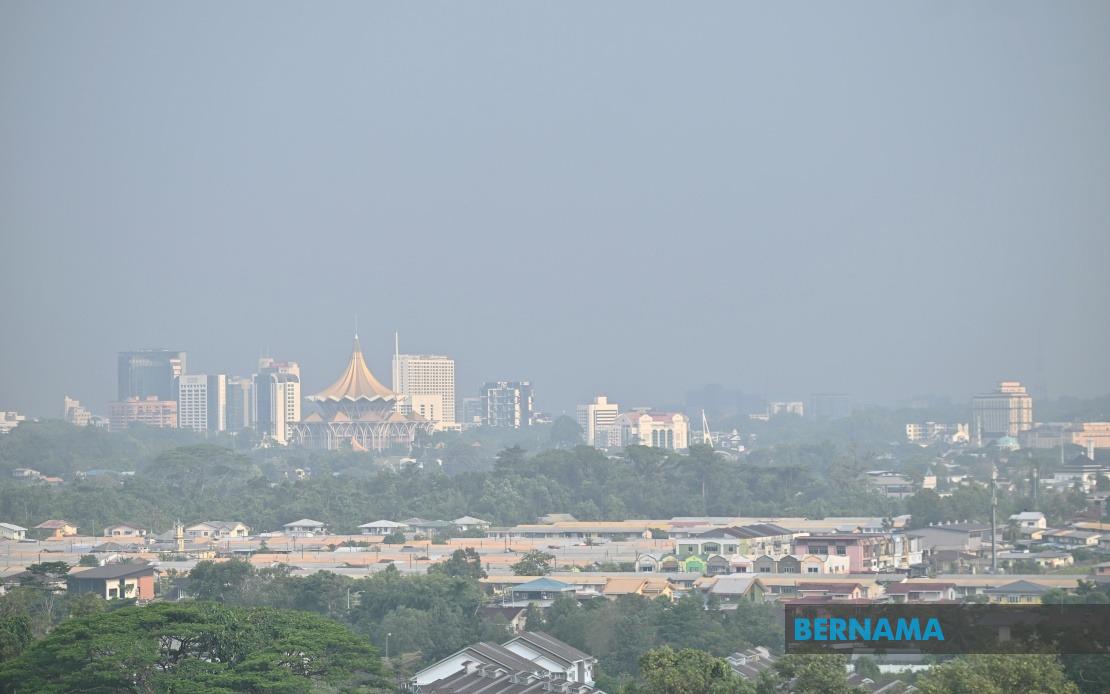
Malaysia's Meteorological Department issued a fresh warning on August 14 that scorching and notably parched weather will continue blanketing Sarawak and surrounding Borneo regions through August 20, raising concerns about mounting haze concentrations and reduced atmospheric visibility particularly in the state's southern portions.
The persistence of these oppressive conditions stems from two converging meteorological factors: sustained southerly wind patterns channelling warm air masses across the island, combined with an exceptionally high concentration of active fire hotspots dotting the Borneo landscape. The combination creates a compounding effect where elevated temperatures dry out vegetation and lower atmospheric moisture content while smoke from burning land masses accumulates in the lower atmosphere, creating hazardous air conditions across affected territories.
By mid-morning on August 14, the Malaysian Air Pollutant Index Management System recorded ten separate locations nationwide experiencing readings classified as unhealthy, a significant portion of these concentrated within Sarawak itself. The clustering of poor air quality readings in the eastern Malaysian state underscores how regional wind patterns and local fire activity converge to create particular vulnerability zones, with residents in southern Sarawak facing the most acute degradation in air conditions. These readings represent a measurable deterioration from earlier patterns and suggest the situation may worsen as the extended hot spell persists.
The arrival of hazardous air quality registers as a recurring challenge for Malaysian authorities, particularly during periods of prolonged drought when fire prevention becomes increasingly critical. The situation in Sarawak carries implications for neighbouring jurisdictions and Southeast Asian trading partners, as transboundary haze events have historically created diplomatic tensions and economic disruptions across the region. The current trajectory suggests careful monitoring and potential diplomatic coordination with Indonesian authorities managing land management practices across the shared maritime boundary.
Simultaneously, MetMalaysia issued distinct meteorological alerts for northwestern and central Peninsular Malaysia, projecting severe thunderstorm activity and intense rainfall throughout Perlis, Kedah, Penang and the Federal Territory of Kuala Lumpur, with the alert remaining active until 1 pm on August 14. This dramatic meteorological divergence illustrates the highly fragmented nature of Malaysia's weather patterns, where simultaneous drought conditions in the east contrast sharply with potentially dangerous precipitation events in the north and centre.
Within Perak, the thunderstorm warning extends to the districts of Kerian, Selama, Larut Matang, Manjung and Bagan Datuk, reflecting the unpredictable advancement of convective systems across the peninsula's topographically varied landscape. The inclusion of specific districts rather than blanket state-wide warnings demonstrates MetMalaysia's increasingly granular forecasting methodology, allowing residents to calibrate their preparedness based on precise geographic coverage.
Selangor residents similarly faced alerts encompassing the northern fringe of the state, including Sabak Bernam and Kuala Selangor, whilst central zones like Klang, Petaling, Gombak and Hulu Selangor also received thunderstorm notices. This geographic specificity reflects how maritime air masses and orographic lifting patterns create highly localized precipitation corridors that shift dynamically throughout the day, making broad generalizations unhelpful for public safety and planning purposes.
The meteorological department continues urging residents to maintain constant awareness of weather developments through multiple information channels. MetMalaysia's dedicated website serves as the primary portal for authoritative forecasts, whilst the department's official social media presence provides real-time alerts and updates suitable for mobile-first populations. The myCuaca mobile application represents the department's contemporary digital engagement strategy, offering push notifications and hyper-local forecasts that enable residents to receive warnings instantaneously rather than awaiting traditional media broadcasts.
For Malaysian businesses and individuals, particularly those in aviation, maritime industries and outdoor sectors, these divergent weather patterns impose significant operational considerations. The combination of hazardous haze in eastern regions and severe thunderstorm potential in northwestern areas creates a complex risk landscape requiring sector-specific contingency planning. Agricultural stakeholders in affected areas must weigh drought risks in Sarawak against flood-related crop damage potential in Peninsular Malaysia.
The extended hot spell forecast through August 20 warrants particular attention from healthcare authorities, as prolonged heat exposure elevates heat-related medical emergencies, particularly among elderly populations and outdoor workers lacking adequate cooling facilities. The accompanying haze conditions compound health risks by degrading air quality and exacerbating respiratory conditions, creating a dual public health challenge requiring coordinated responses from health ministries and environmental agencies.
The meteorological situation unfolding across Malaysia during mid-August encapsulates the country's geographic diversity and climatic complexity, simultaneously presenting drought conditions capable of generating transnational environmental consequences in certain regions whilst threatening precipitation-related hazards elsewhere. Residents across affected territories should prioritise accessing authoritative weather information through official channels whilst implementing appropriate protective measures aligned with their specific geographic exposure. The evolving situation underscores the critical importance of maintaining meteorological monitoring capacity and public alert systems as climate variability increasingly generates complex, regionally differentiated hazard patterns across Southeast Asia.

