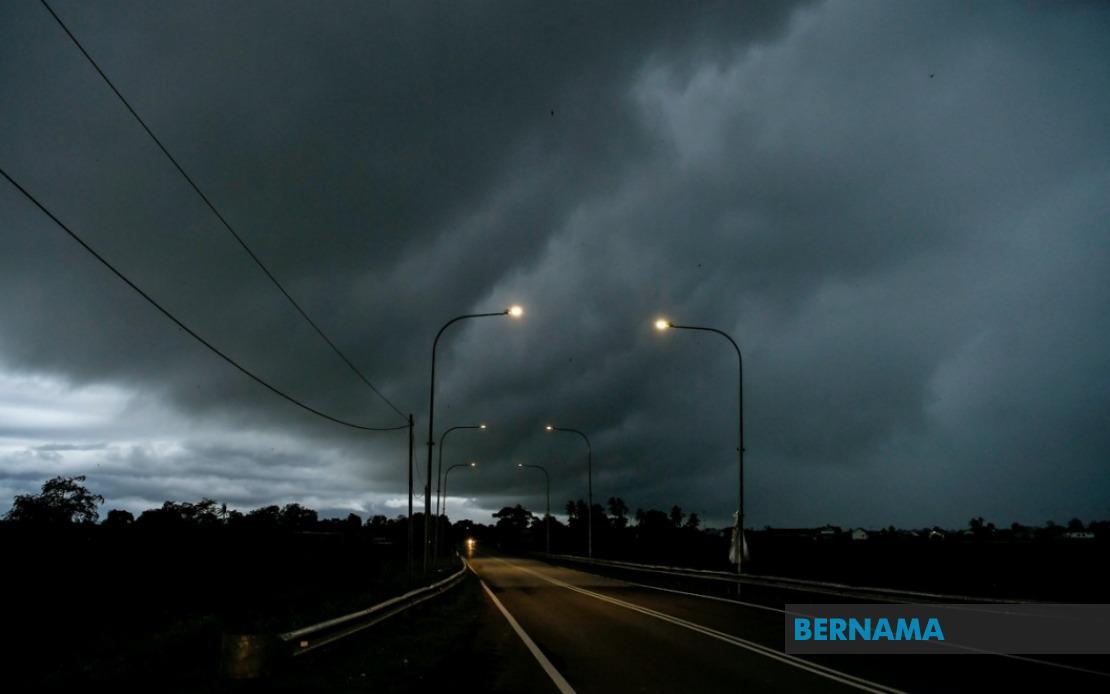
The Malaysian Meteorological Department has activated weather alerts across a significant swathe of the country, warning residents and motorists in nine states, Kuala Lumpur and Putrajaya to prepare for potentially hazardous atmospheric conditions. The alert, which remains in effect until 6 pm, encompasses thunderstorms, heavy rainfall and strong winds—conditions that typically require heightened vigilance, particularly among those engaged in outdoor activities or commuting during peak hours.
On Peninsular Malaysia's west coast, the warning encompasses multiple districts within Perak, spanning both highland and lowland terrain. The affected areas include Hulu Perak, Kuala Kangsar, Kinta, Kampar, Hilir Perak, Batang Padang and Muallim, presenting a diverse geographical footprint from the state's northern reaches to its southern boundaries. Negeri Sembilan has similarly been placed under alert status, while Johor faces the prospect of severe weather conditions across its territory.
The federal territories have also been included in this precautionary measure. Both Kuala Lumpur and Putrajaya residents should anticipate potential disruptions to daily routines, with implications for traffic flow, outdoor events and workplace operations. The capital's congested transportation networks may experience additional strain should thunderstorms materialize during evening commute periods, potentially exacerbating journey times for thousands of workers returning home.
Selangor, Malaysia's most populous state, faces particular concern given its concentration of commercial and residential activity. The warning applies to Sabak Bernam, Kuala Selangor, Hulu Selangor, Gombak, Petaling, Hulu Langat and Sepang—encompassing areas ranging from the state's periphery to its densely populated central regions. These districts include critical economic zones and residential corridors, suggesting the potential for widespread impact across the Klang Valley metropolitan area.
On the east coast, Kelantan faces thunderstorm threats across Tumpat, Pasir Mas, Jeli, Tanah Merah, Kuala Krai and Gua Musang, while Terengganu's coastal and inland districts—including Setiu, Kuala Nerus, Kuala Terengganu, Marang, Dungun and Kemaman—remain vulnerable. Pahang, the peninsula's largest state, is similarly affected across its central and eastern divisions, encompassing highland regions around Cameron, lowland areas such as Temerloh and Kuantan, and the coastal district of Pekan.
East Malaysia has not been spared from this weather system's reach. In Sarawak, the meteorological warning covers diverse geographic zones including the capital region of Kuching, the coastal and riverine areas of Sarikei, Sibu, Mukah and Bintulu, and the northern divisions of Miri and Limbang. The Kapit division, situated in the state's interior, faces similar conditions, underscoring the system's broad geographic extent across the archipelago.
Sabah's warnings extend across three distinct regional zones. The Interior Division encompasses Sipitang, Tenom, Beaufort, Nabawan, Keningau and Tambunan, while the West Coast region—including Papar, Penampang, Kota Kinabalu, Tuaran and Ranau—represents the state's most densely populated and economically significant area. The Sandakan division on the east coast, covering Tongod, Telupid, Beluran and Sandakan itself, rounds out the affected territories in the state.
Thunderstorm warnings of this geographic magnitude typically reflect atmospheric instability across multiple pressure systems and moisture availability. Such conditions frequently occur during afternoon and early evening hours when solar heating reaches its peak, creating convective currents capable of generating severe weather phenomena. The six-hour window provided by the meteorological department suggests forecasters anticipate the system's intensity may diminish as daylight hours conclude and surface heating diminishes.
For residents and businesses across the alert zones, practical considerations include securing loose outdoor items, avoiding unnecessary travel during peak storm intensity, and remaining alert to flash flood risks in low-lying or drainage-prone areas. Transportation authorities may implement traffic management strategies on major routes, particularly where thunderstorm activity concentrates. Schools and outdoor event organizers should factor the alert into scheduling decisions, particularly for late afternoon activities.
The comprehensiveness of this alert—spanning Peninsular Malaysia, Sabah and Sarawak simultaneously—suggests a well-organized atmospheric system capable of generating simultaneous impacts across the nation's diverse geographic regions. Such coordinated warnings underscore the interconnected nature of Southeast Asia's weather patterns, where monsoon influences and local geographic features interact to create complex meteorological scenarios. The Malaysian Meteorological Department's proactive approach provides stakeholders with sufficient advance notice to implement protective measures.
The alert's time-limited nature, concluding at 6 pm, offers some reassurance that the most intense weather activity is anticipated within a defined timeframe. However, residual effects including wet road conditions and occasional heavy showers may persist beyond the official alert period. Residents and commuters should remain vigilant even after the formal warning expires, as atmospheric conditions typically remain unsettled for hours following severe thunderstorm passages.

