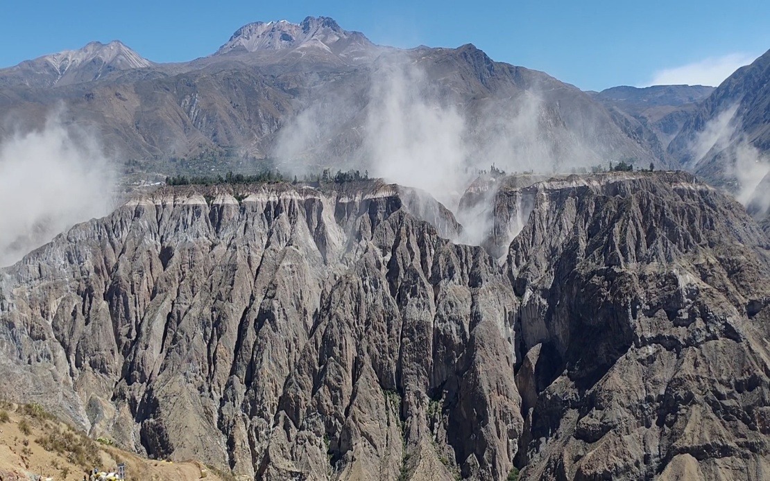
Southern Peru experienced a significant seismic event on Thursday afternoon when a 6.7 magnitude earthquake rumbled through the country's remote interior. The US Geological Survey confirmed the tremor, while Peru's Geophysical Institute reported a marginally higher reading of 7.2 magnitude, a discrepancy that reflects different measurement methodologies used by international and domestic monitoring agencies. The epicentre was located approximately 35 kilometres north of Coracora in Parinacochas province within Ayacucho department, a sparsely populated region in the Andes.
The timing and depth of the earthquake combined to limit immediate harm, despite the substantial magnitude. The tremor occurred at intermediate depth of 108 kilometres beneath the surface, a characteristic that significantly reduced the shaking intensity felt at ground level. This geological buffer meant that much of the seismic energy dissipated through the Earth's crust before reaching populated areas. The Peruvian seismic agency classified the shaking intensity at the epicentre as III to IV on the Mercalli scale, indicating light to moderate disruption rather than the violent shaking that could trigger widespread damage.
The earthquake's reach extended well beyond its epicentre. Residents across southern and central Peru reported noticeable trembling, and the shaking was felt distinctly in Lima, the capital city more than 400 kilometres away. The geographic spread of the event underscored the considerable energy released during the tremor, even as the depth prevented catastrophic surface effects. Peruvian authorities and disaster management agencies coordinated rapid assessments across affected regions to evaluate potential damage, though initial reports indicated no deaths or severe infrastructure collapse.
This seismic event emerges amid a broader pattern of heightened earthquake activity affecting Peru's northern and southern regions. The country sits directly atop the Pacific Ring of Fire, one of the planet's most seismically active zones where tectonic plates collide and create constant geological stress. Peru experiences hundreds of earthquakes annually, ranging from minor tremors to significant events, making seismic preparedness a fundamental public safety priority. The nation's recent uptick in seismic activity has prompted authorities to intensify monitoring and public awareness campaigns.
Peru's modern seismic monitoring infrastructure, including the Geophysical Institute's National Seismological Centre, enables rapid detection and characterization of earthquakes. This capacity represents substantial progress compared to earlier decades when event detection and response were far less coordinated. The relatively accurate initial reporting of Thursday's earthquake reflected decades of investment in seismic science and institutional development. However, the discrepancy between the USGS magnitude reading of 6.7 and the IGP's 7.2 rating highlights how earthquake magnitude determination involves scientific judgment and can vary based on the waves analysed and methodologies applied.
Historical context demonstrates why Peru maintains such vigilance regarding seismic activity. The 2007 earthquake in the Ica region, which registered 7.9 magnitude, remains seared in national memory as a devastating reminder of seismic danger. That disaster claimed nearly 600 lives and caused widespread destruction across southern Peru, demonstrating the catastrophic potential of major earthquakes striking densely populated areas at shallow depths. The contrast between 2007's tragic toll and Thursday's fortunate lack of casualties illustrates how depth, magnitude, population distribution, and building standards collectively determine earthquake outcomes.
For Malaysian and Southeast Asian observers, Peru's experience offers instructive lessons regarding earthquake risk management. While Malaysia lies outside the Ring of Fire, the region does experience seismic activity, particularly in eastern Sabah and along Sumatra. The Indonesian archipelago, sharing tectonic characteristics with Peru due to subduction zone activity, faces similar earthquake hazards. Peru's investment in scientific monitoring, public education, and emergency preparedness protocols provides a regional model worth studying as Southeast Asian nations enhance disaster resilience.
The Peruvian Geophysical Institute responded to the earthquake by issuing broad public advisories urging citizens to maintain preparedness. Authorities recommended that households review evacuation plans, update emergency supply kits, and stay informed through official channels. This proactive messaging, issued in the wake of an earthquake that fortunately caused no documented damage, reflects a sophisticated understanding that public vigilance must remain constant in high-risk seismic zones. Such messaging normalizes earthquake preparedness rather than reserving it only for crisis moments.
The absence of casualties and severe damage from Thursday's earthquake might superficially suggest minimal concern. However, seismic scientists regard the event as significant precisely because it demonstrates the continued energy being released along Peru's subduction zone. Each earthquake, regardless of immediate consequences, remaps crustal stress patterns and alters the probability of subsequent seismic events. The heightened activity observed across northern and southern Peru throughout recent weeks could reflect stress redistribution following major historical earthquakes, or presage future significant events. This interpretive uncertainty reinforces why ongoing scientific monitoring remains essential.
Thursday's earthquake occurred within an interconnected global seismic context. The Pacific Ring of Fire generates approximately 75 percent of the world's active volcanoes and accounts for 90 percent of global earthquake energy release. Events across this system influence stress states at distant locations through complex geological mechanisms. For Peru specifically, understanding regional seismic patterns requires integrating data from earthquake networks spanning the entire Pacific rim, making international scientific cooperation indispensable for accurate hazard assessment.
Looking forward, the incident reinforces Peru's strategic commitment to earthquake science and public safety infrastructure. The nation continues refining early-warning systems designed to provide seconds of advance notification before strong shaking reaches population centres. While brief, such warnings can enable automatic safety responses in hospitals, transit systems, and utilities. Neighbouring countries including Ecuador and Chile have implemented comparable systems, creating a regional framework for earthquake risk reduction across the Andes.
Thursday's earthquake ultimately served as a reminder rather than a catastrophe, a distinction reflecting preparedness and geological fortune. Peru's robust institutional response, accurate data collection, and clear public communication demonstrated how scientific capacity and bureaucratic competence can substantially reduce human suffering during seismic events. For the broader Pacific region and indeed global earthquake-prone areas, such examples underscore the value of investment in disaster science and preparation, investments that pay dividends precisely during the ordinary earthquakes that pose no immediate threat but demand eternal vigilance.

