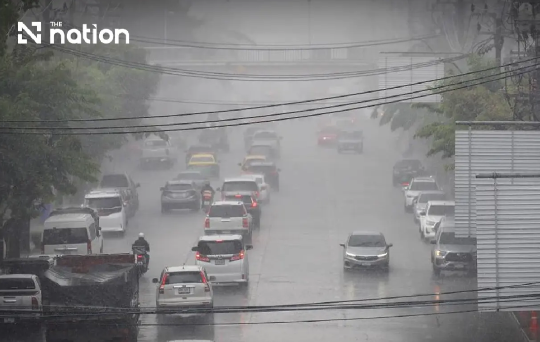
Thailand faces an escalating weather crisis as the Thai Meteorological Department issued its ninth consecutive alert on Wednesday evening, cautioning residents that heavy to extremely heavy rainfall across the northern and northeastern regions poses a severe threat of flash flooding and dangerous water run-off through at least Friday, August 21. The warning underscores growing concerns about the compounding effects of successive rainy days, which accumulate moisture in vulnerable terrain and increase the likelihood of localized inundation that can develop with little warning.
The meteorological system responsible for this unstable pattern stems from a monsoon trough positioned directly over northern Thailand and stretching into the upper northeast, working in tandem with a notably vigorous southwest monsoon over the Andaman Sea and Gulf of Thailand. This dual atmospheric setup creates a particularly potent precipitation engine, funneling moisture inland from maritime regions while simultaneously destabilizing air masses already resident over land. The convergence of these conditions explains why forecasters characterize the hazard as distinctly elevated rather than routine seasonal rain.
Communities in foothill zones and low-lying areas warrant particular caution, as the terrain funnels water downslope with considerable force once saturation thresholds are exceeded. The department specifically flagged elevated risks near waterways and in natural drainage channels where sudden swelling can trap residents or damage infrastructure within minutes. Motorists face particular jeopardy; authorities advise avoiding routes through historically flood-prone low areas, where temporary submersion can isolate vehicles and endanger occupants far more rapidly than typical rainfall events. The dual imperative to remain vigilant yet plan journeys with meticulous care reflects the genuine unpredictability inherent in these meteorological circumstances.
In the northern region, thunderstorm probability reaches approximately eighty percent coverage from Wednesday evening through Thursday evening, with heavy precipitation anticipated across Chiang Mai, Chiang Rai, Phayao, Lamphun, Sukhothai, Tak, Kamphaeng Phet and Phichit. Conditions escalate further in Mae Hong Son, Lampang, Nan, Phrae, Uttaradit, Phitsanulok and Phetchabun, where very heavy rainfall constitutes a genuine possibility. Daytime temperatures will moderate to between twenty-eight and thirty-four degrees Celsius, while southwesterly winds persist at moderate strength around ten to twenty kilometres per hour. The relatively mild wind speeds paradoxically heighten flood risk by allowing rainwater to accumulate rather than dispersing moisture through atmospheric mixing.
Northeastern provinces experience similarly daunting conditions, with eighty percent thunderstorm coverage anticipated across a broad swathe of the region. Heavy rain appears likely in Nong Bua Lamphu, Chaiyaphum, Khon Kaen, Maha Sarakham, Roi Et, Yasothon, Amnat Charoen, Nakhon Ratchasima, Buriram, Surin, Si Sa Ket and Ubon Ratchathani, while Loei, Nong Khai, Bueng Kan, Udon Thani, Sakon Nakhon, Nakhon Phanom, Kalasin and Mukdahan face the possibility of torrential downpours. For Malaysian observers, this northeastern belt represents Thailand's economically vital agricultural heartland, where flooding can devastate crops and disrupt regional supply chains affecting broader Southeast Asian commerce.
The Central region and eastern seaboard encounter lesser but still significant precipitation risks. Central Thailand experiences thunderstorm prospects over roughly sixty percent of its expanse, with heavy rainfall possible across Nakhon Sawan, Phra Nakhon Si Ayutthaya, Lop Buri, Saraburi, Kanchanaburi and Ratchaburi. The East sees seventy percent storm coverage, with heavy rain forecast for Nakhon Nayok, Prachin Buri, Sa Kaeo, Chachoengsao and Chanthaburi, whilst Trat faces very heavy precipitation. These eastern provinces warrant particular attention given their proximity to Cambodia and their role as transit corridors for regional trade, where infrastructure disruption carries ripple effects across borders.
Maritime safety constitutes an equally serious dimension of this weather event. The upper Andaman Sea and upper Gulf of Thailand will experience wave heights of two to three metres under normal conditions, rising above three metres during thunderstorm activity. All vessels navigating these waters should proceed with heightened caution, and maritime authorities have advised small boats to remain at harbour throughout the three-day warning period. The lower Andaman Sea presents relatively milder conditions with two-metre waves, though maritime operators must remain cognisant that thunderstorm cells can unexpectedly intensify local sea states. For nations like Malaysia with substantial fishing fleets and maritime commerce, these regional advisories carry direct operational consequences for vessels transiting Thai waters.
Bangkok and its satellite provinces face more moderate hazards than the peripheral regions, with thunderstorm prospects capped at roughly sixty percent coverage and only isolated heavy rainfall anticipated. Nevertheless, the capital's notorious drainage challenges mean that even moderate rainfall can create temporary disruptions to transport and business operations. Temperatures in the metropolitan area will range from twenty-five to twenty-seven degrees Celsius overnight to thirty-three to thirty-five degrees Celsius during daylight hours, creating a humid, uncomfortable environment even when precipitation temporarily abates.
The southern coastline experiences differentiated conditions based on orientation and latitude. The eastern southern coast anticipates thunderstorms across forty percent of its territory, chiefly affecting Phetchaburi, Prachuap Khiri Khan, Chumphon and Surat Thani, with temperatures ranging from twenty-three to twenty-seven degrees Celsius minimum to thirty-three to thirty-six degrees maximum. In the northern portion from Surat Thani stretching northward, southwesterly winds will strengthen to twenty to thirty-five kilometres per hour, generating two to three metre waves that exceed two metres in deeper offshore waters and during thunderstorms. The region further south from Nakhon Si Thammarat experiences comparatively lighter winds at fifteen to thirty-five kilometres per hour, with one to two metre offshore waves escalating above two metres during severe weather activity.
Thailand's authorities have structured their advisory system to convey urgency appropriate to risk stratification across diverse geographical zones. This ninth warning represents neither alarmism nor routine notification but rather a calibrated communication reflecting accumulating moisture, unfavourable upper-atmosphere dynamics, and the particular vulnerability of specific terrain types to rapid inundation. For Malaysian residents and businesses with exposure to Thai operations, whether through supply chains dependent on northeastern agricultural output or maritime interests operating in Thai waters, this developing situation warrants sustained monitoring through official Thai meteorological updates and consideration of contingency measures should conditions deteriorate further.

