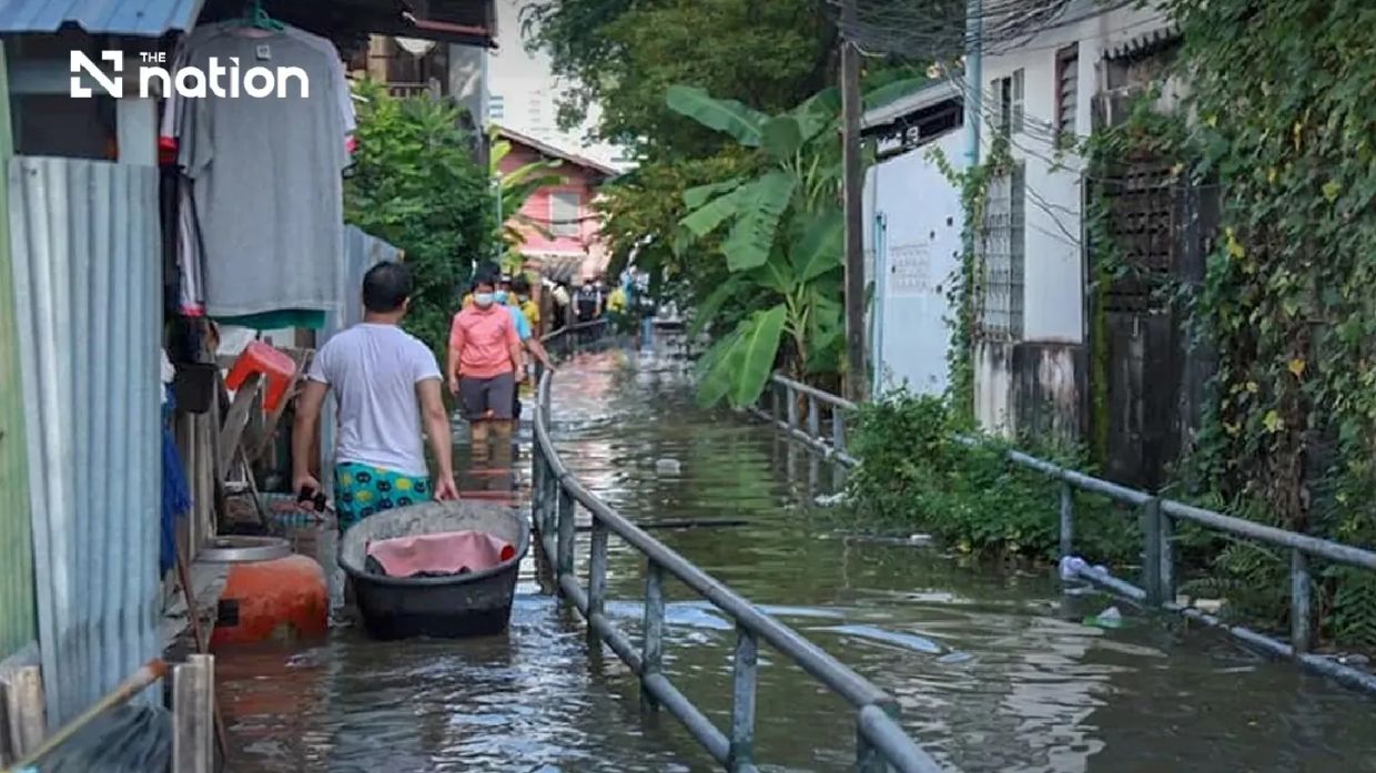
Thailand's Department of Disaster Prevention and Mitigation has activated an alert system spanning six central provinces and the capital, requiring intensive monitoring of tidal conditions expected to elevate water levels along critical river systems throughout the coming week. The warning, issued on Saturday at noon, targets Pathum Thani, Nonthaburi, Nakhon Pathom, Samut Sakhon, Samut Songkhram, and Samut Prakan alongside Bangkok itself, with the high-tide period extending from Monday, July 13, through Sunday, July 19. This coordinated response reflects mounting concern that peak sea-level events could trigger riverbank breaches and canal overflows in vulnerable communities.
Director-General Theerapat Kachamat confirmed that the advisory draws on real-time hydrographic intelligence supplied by the Royal Thai Navy's Hydrographic Department, which has identified a specific window of elevated risk. Data indicates that water levels in the Chao Phraya River, particularly around Phra Chulachomklao Fort and adjacent reaches, will surge between 6pm and 10pm each evening during the alert period. While the timeframe is limited to a few hours nightly, the cumulative effect over seven consecutive days poses significant strain on existing flood-management infrastructure and protective barriers.
The geographic scope of the warning underscores the interconnected vulnerability of Thailand's central flatlands and the Greater Bangkok metropolitan zone. In Pathum Thani, authorities will focus on Mueang Pathum Thani and Sam Khok districts, where riverside settlements and agricultural communities face routine tidal pressures. Nonthaburi's Mueang, Pak Kret, and Bang Kruai districts lie directly adjacent to the capital's boundary and experience compounded flooding risk from both local drainage constraints and external water surges. Nakhon Pathom's Bang Len, Nakhon Chai Si, and Sam Phran districts, positioned further upstream, are nevertheless susceptible to backwater effects when downstream water levels rise sharply.
Samut Songkhram, the smallest and most flood-prone of Thailand's central provinces, faces danger across all its administrative divisions, reflecting its extremely low elevation and proximity to the Gulf of Thailand. Samut Prakan's Mueang, Phra Samut Chedi, Phra Pradaeng, and Bang Bo districts occupy the river's mouth zone, where tidal influence is most pronounced, creating a direct transmission mechanism for marine water to propagate inland through the Chao Phraya system. Bangkok itself, despite its sophisticated drainage networks, remains perpetually at risk from high-tide events that can overwhelm pumping stations and inundate communities built on reclaimed or subsiding land.
The hazard profile extends beyond simple water-level rise. The disaster agency specifically warns of riverbank overflows that could saturate unprotected embankments and inundate low-lying neighbourhoods lacking permanent flood defences. Communities situated outside engineered barrier systems—a category encompassing numerous informal settlements and older residential zones—face acute exposure. Additionally, agricultural areas and commercial zones operating within the flood-prone corridor must prepare for potential operational disruption, with particular attention directed toward floating restaurants and river-based businesses whose assets could be damaged or temporarily unusable.
Provincial and municipal authorities have received explicit instructions to mount a comprehensive public awareness campaign. The messaging protocol requires notification of business operators whose operations depend on river and canal access, combined with direct alerts to residents occupying riverside plots or low-elevation property. This layered communication strategy recognizes that effective disaster mitigation depends not merely on government preparedness but on community-level vigilance and timely individual decisions to secure property or relocate temporarily. The emphasis on advance notice reflects hard-won lessons from prior flooding episodes in which inadequate public understanding of timing and severity delayed protective action.
The Central Disaster Prevention and Mitigation Command, coordinating through the DDPM, has tasked provincial governors with activating relevant emergency-response agencies and liaising with private-sector operators whose infrastructure may be affected. This partnership model acknowledges that much critical infrastructure—including riverbank defences and maritime facilities—operates under mixed public-private stewardship. Restaurant operators, construction companies engaged in waterfront projects, and logistics enterprises managing river transport must receive explicit notification of the tidal window, enabling them to adjust schedules and secure vulnerable assets before water levels peak.
For Malaysian readers, the Thai experience carries direct relevance, as the Chao Phraya system's behaviour influences broader Southeast Asian hydrological patterns and demonstrates the operational challenges faced by countries managing major river systems in monsoon-affected regions. The coordination visible in Thailand's response—linking naval hydrographic expertise, civilian disaster agencies, provincial administration, and public communication channels—offers a model for regional disaster-management frameworks. Moreover, the vulnerability of central Thailand's flatlands parallels conditions in Malaysia's own low-lying coastal and riverine zones, making the Thai alert system's lessons applicable to domestic flood-preparedness planning.
Residents and affected entities can access real-time warning information through the THAI DISASTER ALERT mobile application, enabling self-directed monitoring of conditions. For those experiencing emergencies or requiring immediate assistance, the government has established multiple reporting mechanisms: the LINE social-media platform accessible via ID @1784DDPM and a 24-hour telephone hotline at 1784. These channels permit individuals to report incidents and request emergency support, ensuring that response coordination can begin promptly when water levels rise unexpectedly or cause damage to lives and property.
The week-long alert underscores the reality that flood management in densely populated river deltas demands continuous vigilance and rapid communication. Although the high-tide window each evening lasts only four hours, the repetitive nature of the event across successive days means that cumulative fatigue and system strain could amplify secondary impacts. Communities that successfully navigate Monday through Wednesday may face heightened vulnerability by the week's end if protective measures have degraded or if secondary drainage channels have become saturated. The alarm thus represents not a single crisis point but an extended period requiring sustained operational and social readiness across government, business, and household levels.

