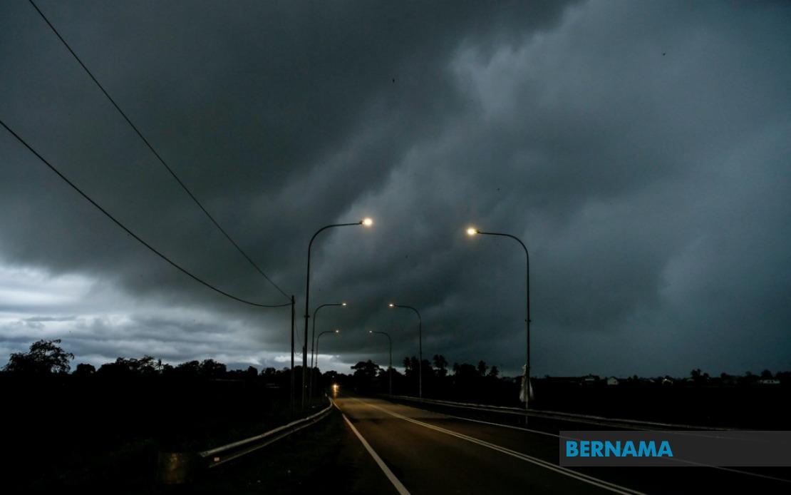
The Malaysian Meteorological Department has activated weather alerts across a significant portion of the country, cautioning residents and commuters to prepare for dangerous atmospheric conditions expected throughout the evening. The thunderstorm warning, which encompasses nine states and the federal territory of Labuan, remains in effect until 9 pm and carries the potential for flash flooding, reduced visibility on roads, and hazardous wind gusts that could damage structures and disrupt utilities.
Northern Malaysian states bear the brunt of the alert, with the entire state of Perlis placed under warning, whilst Kedah's affected districts include the popular tourist destination of Langkawi alongside Kubang Pasu, Kota Setar, Pokok Sena, Padang Terap, Sik and Baling. In Perak, residents of Kerian, Larut and Matang, Selama, Kuala Kangsar, Kinta and Kampar should remain vigilant. This concentration of warnings in the northern corridor reflects the typical monsoon patterns that characterise this period of the Malaysian weather calendar, when atmospheric instability peaks during late afternoon and early evening hours.
Central Malaysia is also in the meteorological department's crosshairs, with specific districts targeted rather than blanket coverage. Cameron Highlands, the hill station famous for its tea plantations and cooler temperatures, joins Bentong, Bera and Rompin in Pahang on the alert list. The Hulu Langat area in Selangor, which includes suburban communities and industrial zones downstream of the capital, faces particular risk of localised flooding given the terrain's geography. Negeri Sembilan's Jelebu and Jempol districts round out peninsular Malaysia's coverage, whilst Johor's southern districts of Segamat, Kluang and Mersing face similar warnings, creating a band of heightened weather vigilance across the country's midsection.
Sarawak's extensive coastline and interior regions have drawn substantial meteorological concern, with multiple divisions affected by the impending severe weather. Kuching, the state capital, has both its urban core and the Bau district flagged, alongside Serian to the east. The Samarahan division, encompassing both Samarahan and Asajaya, joins Sarikei's Meradong area and the riverside town of Sibu in the warning zone. Further north and east, Mukah's Tanjung Manis, the Kapit division's Song and Kapit areas, Bintulu's Tatau and Sebauh districts, and Miri's Marudi region all face the prospect of heavy downpours and electrical storms.
Limbang, which straddles Sarawak's border with Brunei, completes the East Malaysian picture for Sarawak. This extensive coverage reflects the interconnected atmospheric systems that frequently affect Borneo during the southwest monsoon season, when moisture-laden air masses converge over the island's interior highlands before descending toward coastal lowlands. The warnings for these areas take on added significance given the region's vulnerability to landslides and flash flooding, phenomena that have historically caused considerable disruption and property damage in populated zones.
Sabah's warning encompasses both interior and coastal zones, reflecting the state's diverse topography and settlement patterns. The interior districts of Sipitang, Kuala Penyu, Beaufort and Tambunan represent mountainous terrain where rapid runoff from heavy rainfall poses particular hazards to communities nestled in river valleys. Sabah's west coast, home to Kota Kinabalu and other major population centres, faces the prospect of severe weather disruption during peak evening hours when commercial and residential activity reaches its zenith. The Sandakan division, specifically Tongod and Kinabatangan districts in the state's east coast region, completes the Sabah alert zone, with these areas particularly susceptible to inundation given their proximity to major river systems.
The timing of this alert carries practical implications for Malaysian commuters and business operations. Evening rush hour traffic on major highways in affected regions could face significant delays as visibility plummets and road conditions deteriorate. Public transport operators may experience service interruptions, whilst outdoor events and gatherings should be postponed or relocated to covered venues. Residents in flood-prone areas, particularly those in low-lying districts and informal settlements, should consider precautionary measures including moving valuables to higher floors and staying informed through official weather updates.
Schools and workplaces in the affected zones may need to adjust schedules or implement work-from-home arrangements depending on conditions, whilst construction sites and outdoor industrial operations should suspend activities that create weather-related hazards. Utility companies are typically placed on heightened alert during such warnings, with teams pre-positioned to respond rapidly to downed power lines or infrastructure damage caused by strong winds. Agricultural areas, particularly those engaged in intensive cultivation or animal husbandry, require protective measures to minimise crop loss and livestock exposure.
The breadth of this meteorological warning underscores the interconnected nature of Malaysia's weather systems and the capacity for severe atmospheric conditions to develop rapidly during peak heating hours. Residents across the affected regions are advised to monitor official MetMalaysia updates and heed any escalating warnings, as thunderstorm alerts can intensify into storm watches or warnings if conditions warrant. The evening timeframe makes this particularly relevant for communities still engaged in outdoor activities, outdoor food vending, and street-level commerce that characterises Malaysian urban and suburban life during twilight hours.