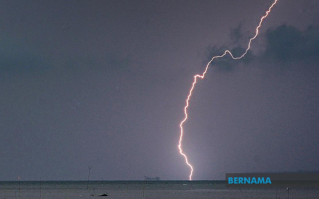
The Malaysian Meteorological Department has issued an alert for adverse weather conditions spanning seven states and the federal territory of Labuan, with the warning remaining in effect until 5 pm. The advisory encompasses a substantial geographical area stretching across the peninsula and the island of Borneo, indicating a significant weather system affecting the nation's population centres and regional corridors.
In Kedah, the warning covers Baling district, a central region of the state known for its rubber and rice production. The Perak alert is far more extensive, touching nine districts: Manjung, Kinta, Perak Tengah, Kampar, Bagan Datuk, Hilir Perak, Batang Padang and Muallim. This coverage reflects the state's vulnerability during the southwest monsoon transition period, when moisture-laden winds interact with the Titiwangsa Range to produce convective activity. The concentration of warnings in Perak suggests particular atmospheric instability over the region.
Terengganu faces threats in seven districts including both coastal and inland areas. Setiu, Kuala Nerus, Kuala Terengganu, Marang and Dungun lie along the east coast, while Hulu Terengganu and Kemaman extend inland. This pattern indicates that the weather system is affecting both maritime and terrestrial zones, potentially creating hazardous conditions for fishing communities and coastal traffic while simultaneously impacting inland settlements and agricultural areas dependent on predictable water supplies.
Pahang's warning covers a smaller but strategically important cluster: the Cameron Highlands hill station along with Lipis, Jerantut and Kuantan. The inclusion of Tanah Tinggi Cameron, at elevated altitude, suggests instability throughout the atmospheric column rather than surface-level phenomena alone. Heavy rainfall in the highlands could influence downstream water levels and create flash flood risks in the Rajang river system and tributary valleys.
In Selangor, four districts are on alert: Sabak Bernam in the northern coastal area, Kuala Selangor along the coast, plus the inland regions of Hulu Selangor and Gombak. This spread indicates that the weather disturbance encompasses the economically crucial Selangor region, potentially affecting traffic on major expressways, disrupting commercial activity in Kuala Lumpur's satellite towns, and impacting the federal territory's eastern boundaries.
Johor's affected districts—Kluang, Mersing, Pontian, Kulai, Kota Tinggi and Johor Bahru—include both southern peninsular zones and strategic economic areas. Johor Bahru, as the state capital and major commercial hub, warrants particular concern given its dense urban population and critical infrastructure. Mersing, a coastal town catering to island tourism, could face disruptions to maritime access to the Tioman and Aur archipelagos.
Sabah's warning zone extends across multiple regions: the Interior (Kuala Penyu, Beaufort and Tambunan), the West Coast, Sandakan's Beluran district, and Kudat in the north. This distribution reflects Sabah's exposure to equatorial weather patterns and the convergence zones that develop during transitional monsoon periods. The Interior plateau districts, though sparsely populated, serve as water catchment areas critical for downstream communities.
The meteorological department's alert specifically mentions thunderstorms, heavy rain and strong winds as the primary hazards. Thunderstorms in Malaysia during transitional periods typically develop rapidly, creating flash flooding in low-lying areas, poor visibility that complicates road conditions, and occasional hail. Strong winds accompanying such systems can topple trees, damage structures and disrupt power supplies. Heavy rainfall intensity poses the most serious risk, particularly in areas with poor drainage, steep topography or inadequate flood mitigation infrastructure.
For residents across the affected zones, the afternoon deadline of 5 pm suggests the weather system follows a typical diurnal cycle, with heating during the day triggering convection that should diminish during evening hours. However, this timeline remains provisional, subject to the actual movement and intensity of the meteorological system. Commuters should prepare for potential delays on major routes, monitor traffic and weather updates continuously, and consider postponing non-essential travel during the warning period.
The geographical pattern of this alert reflects broader seasonal transition dynamics occurring across Southeast Asia during mid-to-late July. The monsoon transition between the southwest and northeast patterns creates zones of enhanced atmospheric instability, particularly where wind patterns converge or interact with topography. Malaysia's position relative to these patterns means such widespread weather alerts occur with regularity during certain periods, testing both the country's meteorological forecasting capabilities and public preparedness systems.
For economic sectors dependent on weather stability—agriculture, construction, maritime commerce and tourism—such warnings necessitate contingency planning. The disruption costs from severe weather events, when multiplied across these seven states and Labuan, accumulate rapidly. Industries relying on just-in-time logistics face supply chain complications, while event-based tourism suffers immediate revenue loss. Successive warnings over consecutive days can amplify economic impacts beyond single-day disruptions.
The timeliness of MetMalaysia's alert underscores the importance of early warning systems in the Malaysian context, where rapid urbanization and infrastructure development have reduced natural flood buffers. Citizens receiving such alerts should treat them seriously, taking precautions such as securing loose items, avoiding outdoor activities and delaying unnecessary journeys. The five-hour window provides reasonable opportunity for preparation, though those caught unexpectedly in severe weather should seek immediate shelter and avoid travelling through flooded areas.

