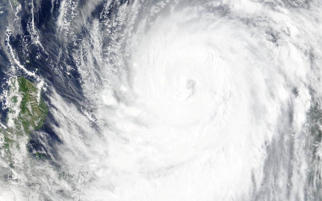
Taiwan braced for significant weather disruption Thursday as its Central Weather Bureau escalated storm alerts ahead of Typhoon Bavi's arrival, marking the ninth major tropical system to threaten the island this year. Issued at 2.30 pm local time, the sea warning expanded protective measures across vulnerable maritime zones, signalling meteorologists' growing concern about the system's trajectory and intensity. Officials indicated that a full land warning would likely follow within hours as the typhoon continued its northwestern advance toward the densely populated island.
The maritime alert encompassed waters surrounding Taiwan's most exposed regions, with particular attention paid to the northeastern and southeastern coastal approaches, both of which regularly experience the brunt of Pacific typhoons. The warning specifically covered Orchid Island and Green Island, two inhabited outposts that sit directly in the path of most northwestward-tracking systems, as well as the strategically important Bashi Channel, a waterway separating Taiwan from the northern Philippines. These locations routinely face the most severe weather conditions during tropical cyclone passages, experiencing dangerous swells and reduced visibility that render normal maritime operations untenable.
At the time of the warning's issuance, Bavi occupied a position southeast of Eluanbi, Taiwan's southernmost geographical extremity, while maintaining its northwestern heading. The typhoon's sustained maximum winds had reached 51 metres per second in the immediate vicinity of its centre, with peak gusts climbing to 63 metres per second—classifications that placed it squarely within the strong typhoon category. These wind speeds possess sufficient destructive potential to overturn vehicles, snap trees, and cause widespread structural damage to buildings, explaining why authorities moved swiftly to implement precautionary measures across transportation networks.
Forecasters projected that Bavi would continue tracking northwest at a relatively measured pace of 15 to 20 kilometres per hour, allowing the system several hours to approach the island before making its closest pass. The predicted trajectory suggested the typhoon would track north of Taiwan rather than making direct landfall, though meteorological models indicated the storm's outer bands would still subject the island to significant weather impacts. Depending on the precise path and any last-minute intensity fluctuations, forecasters suggested Taiwan could experience either the lower end of the strong typhoon category or the upper threshold of moderate typhoon conditions—a distinction that carries meaningful implications for damage assessments and emergency response requirements.
The approaching system had already begun disrupting the region's interconnected transportation infrastructure before formal warnings took effect. Most regularly scheduled flights operating between Taiwan and Okinawa, representing one of East Asia's busier regional air corridors, faced cancellation as airlines proactively suspended operations to protect aircraft from severe wind and weather conditions. Beyond these short-haul services, several long-haul international flights originating from or transiting through Taiwan similarly entered cancellation lists, underscoring the far-reaching economic and logistical consequences of major tropical cyclones in Southeast Asia's transportation ecosystem.
Maritime transport networks experienced equally severe disruption, with ferry operators suspending multiple routes linking Taiwan to outlying islands and nearby territories. The decision to halt ferry services reflected not merely the current weather situation but also forecasters' confidence in Bavi's approach, as ferry cancellations typically occur only when operators and authorities believe conditions will deteriorate beyond safe operating parameters within the next 24 to 48 hours. Additionally, authorities implemented alert status for Taiwan's extensive mountain road network, a precautionary step designed to minimize casualties among drivers who might otherwise venture into terrain prone to landslides, rockfalls, and flash flooding during intense precipitation events.
For Malaysia and the broader Southeast Asian region, Typhoon Bavi represents another reminder of the tropical cyclone season's relentless pace and the interconnectedness of regional weather systems. While Taiwan absorbs the immediate impacts, such major storm systems frequently generate downstream effects that influence weather patterns and precipitation across the South China Sea and neighboring territories. The storm's progression will receive close monitoring from meteorological agencies throughout Malaysia, as autumn season tropical systems occasionally track southwestward toward the region after passing through Taiwan or the Philippines.
The economic dimensions of Bavi's approach merit particular attention, given Taiwan's significance as a global semiconductor manufacturing hub and crucial node in East Asia's supply chain networks. Transportation disruptions, even temporary ones, can cascade through interconnected industries across the region, affecting component shipments and production schedules that extend far beyond Taiwan's borders. Malaysian manufacturers and traders with business relationships on the island face potential delays in receiving materials and completing export commitments during the critical weather window.
Taiwan's emergency management agencies have refined their response protocols significantly over recent decades, benefiting from repeated exposure to major tropical systems. The early issuance of maritime and impending land warnings reflects institutional maturity in disaster preparedness, allowing residents and businesses adequate time to secure property, stock supplies, and position emergency personnel strategically. Such proactive approaches have demonstrably reduced casualty rates and economic losses compared to responses in less-prepared jurisdictions, offering valuable lessons for other storm-prone Asian nations considering improvements to their early warning systems and public communication strategies.

