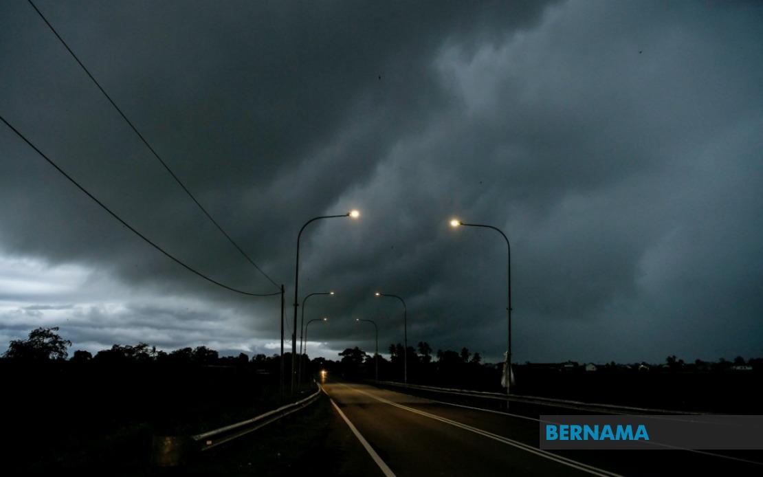
The Malaysian Meteorological Department issued a weather alert on Monday covering thunderstorms, torrential downpours and violent gusts extending through the early hours of Tuesday morning across significant portions of the country. The alert encompasses multiple districts distributed across six states on Peninsular Malaysia alongside the East Malaysian territories, reflecting a broad front of atmospheric instability expected to sweep the region.
On the west coast of Peninsular Malaysia, Kedah faces potential severe weather in three administrative districts: Padang Terap, Sik and Baling. These areas, which span from the northeastern regions down through the central portions of the state, may experience the full brunt of the approaching system. The alert pattern suggests a weather system moving through the northern corridor, with forecasters predicting concentrated activity in specific zones rather than blanket coverage of the entire state.
Perak's Hulu Perak district is also flagged in the warning, indicating that the inland regions of this state are particularly vulnerable to the incoming disturbance. This region's geography, characterised by river valleys and elevation changes, may amplify local weather phenomena and necessitates heightened awareness among residents and emergency services in these areas.
Kelantan, positioned along the northeastern coast and historically prone to weather volatility, faces alerts across five separate districts: Tumpat, Pasir Mas, Jeli, Tanah Merah and Kuala Krai. The concentration of warnings across this state reflects the vulnerability of its eastern position and the likelihood that maritime influences may intensify the system as it approaches the South China Sea coast. These districts encompass both riverine and coastal communities, each with distinct exposure profiles to heavy precipitation and flooding risks.
Pahang's Jerantut district rounds out the Peninsular Malaysia portion of the alert. Located in the state's interior and serving as a gateway to Taman Negara, this district's vulnerability highlights concerns about inland rainfall accumulation and potential impacts on forest hydrology and river systems that feed into larger drainage basins.
Sarawak accounts for the largest portion of warned areas, reflecting the monsoon patterns and geographic factors that make East Malaysia particularly susceptible to heavy convective activity. The alert covers a vast swathe of the state, from the urban centre of Kuching through to the coastal regions of Bintulu and Miri, and extending inland to Kapit. Specific districts mentioned include Serian and Samarahan near Kuching, the central regions of Sri Aman, Sibu and Sarikei, the upriver localities of Kapit and Bukit Mabong, and the northern expanse encompassing Subis, Beluru, Marudi and various other divisions. The breadth of coverage underscores how Sarawak's exposure to weather systems from multiple directions makes comprehensive warnings necessary during periods of atmospheric instability.
Sabah likewise features across three distinct geographical zones within its alert parameters. The Interior division including Kuala Penyu, the West Coast region comprising Putatan and Ranau, and the Sandakan division with Telupid and Beluran all fall within the warning envelope. This distribution reflects both the state's position at the confluence of multiple weather patterns and the vulnerability of its diverse topography to intense precipitation events.
Labuan, the federal territory located off Sabah's coast, completes the affected areas. As an island administration serving as a financial and commercial hub, weather disruptions here carry implications beyond local impacts, potentially affecting maritime traffic and business operations in this strategically important location.
The meteorological department's decision to fragment warnings by specific districts rather than issuing blanket state-wide alerts reflects advances in forecasting precision, allowing authorities and residents to calibrate their response based on localised risk assessments. However, the sheer geographic dispersion of these districts—spanning over a thousand kilometres from Kedah in the north to Limbang in the northeast of Borneo—underscores the scale of the atmospheric phenomenon driving the alert.
For Malaysians in these regions, the alert signals need for heightened precautions: securing loose outdoor items, avoiding unnecessary travel in affected areas, and monitoring official updates for any escalation or extension of the warning period. Those in flood-prone communities should particularly heed the alert, as the combination of thunderstorms with heavy rainfall creates conditions favouring rapid runoff and potential overflow of drainage systems already stressed by the monsoon season.
The validity period extending to 1 am the following day provides a defined window during which residents and disaster management authorities can concentrate their attention and resources. However, should conditions deteriorate or patterns shift, MetMalaysia typically issues updated alerts with revised timings, making it prudent for those in affected areas to maintain awareness of official weather services throughout the alert period.
%22%2F%3E%3C%2Fpattern%3E%3C%2Fdefs%3E%3Crect%20width%3D%22100%25%22%20height%3D%22100%25%22%20fill%3D%22url(%23ph3na2wg)%22%2F%3E%3Crect%20width%3D%22100%25%22%20height%3D%22100%25%22%20fill%3D%22url(%23ph3na2wp)%22%2F%3E%3Ctext%20x%3D%2250%25%22%20y%3D%2250%25%22%20text-anchor%3D%22middle%22%20dominant-baseline%3D%22central%22%20fill%3D%22rgba(255%2C255%2C255%2C0.95)%22%20font-family%3D%22Georgia%2C%20'Times%20New%20Roman'%2C%20serif%22%20font-weight%3D%22700%22%20font-size%3D%22272%22%20letter-spacing%3D%22-0.02em%22%3EPerak%3C%2Ftext%3E%3C%2Fsvg%3E)